Dr Manisha Laddha
Tapovan, Gaumukh, Mount Shivling, Mount Meru, and Mount Bhagirathi Trip
*Tapovan, Gaumukh, Mount Shivling, Mount Meru, and Mount Bhagirathi*
forms one of the most sacred and geographically important high-altitude landscapes in the Indian Himalayas. It is not only geologically significant, but also deeply rooted in Indian mythology and spirituality, especially in the context of the river Ganga (Ganges).
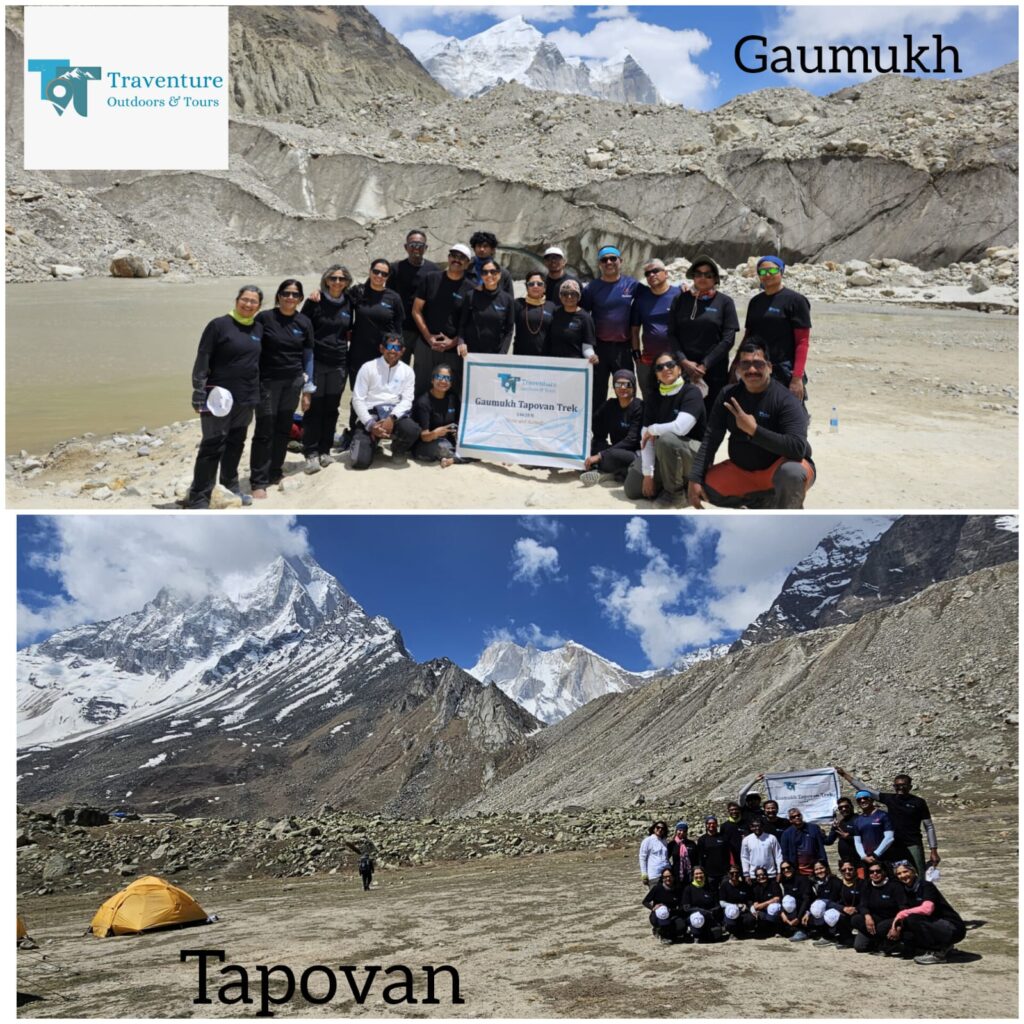
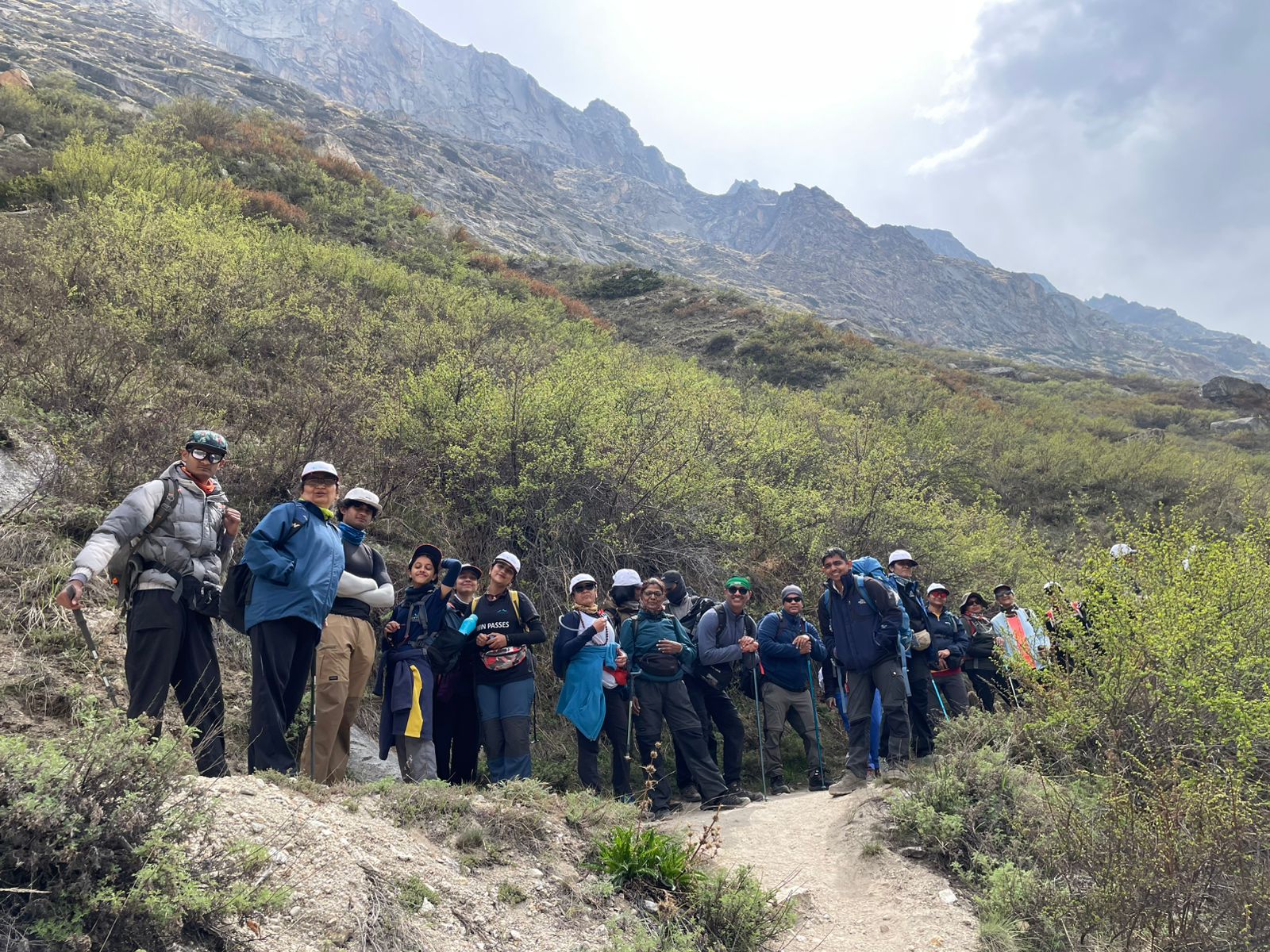
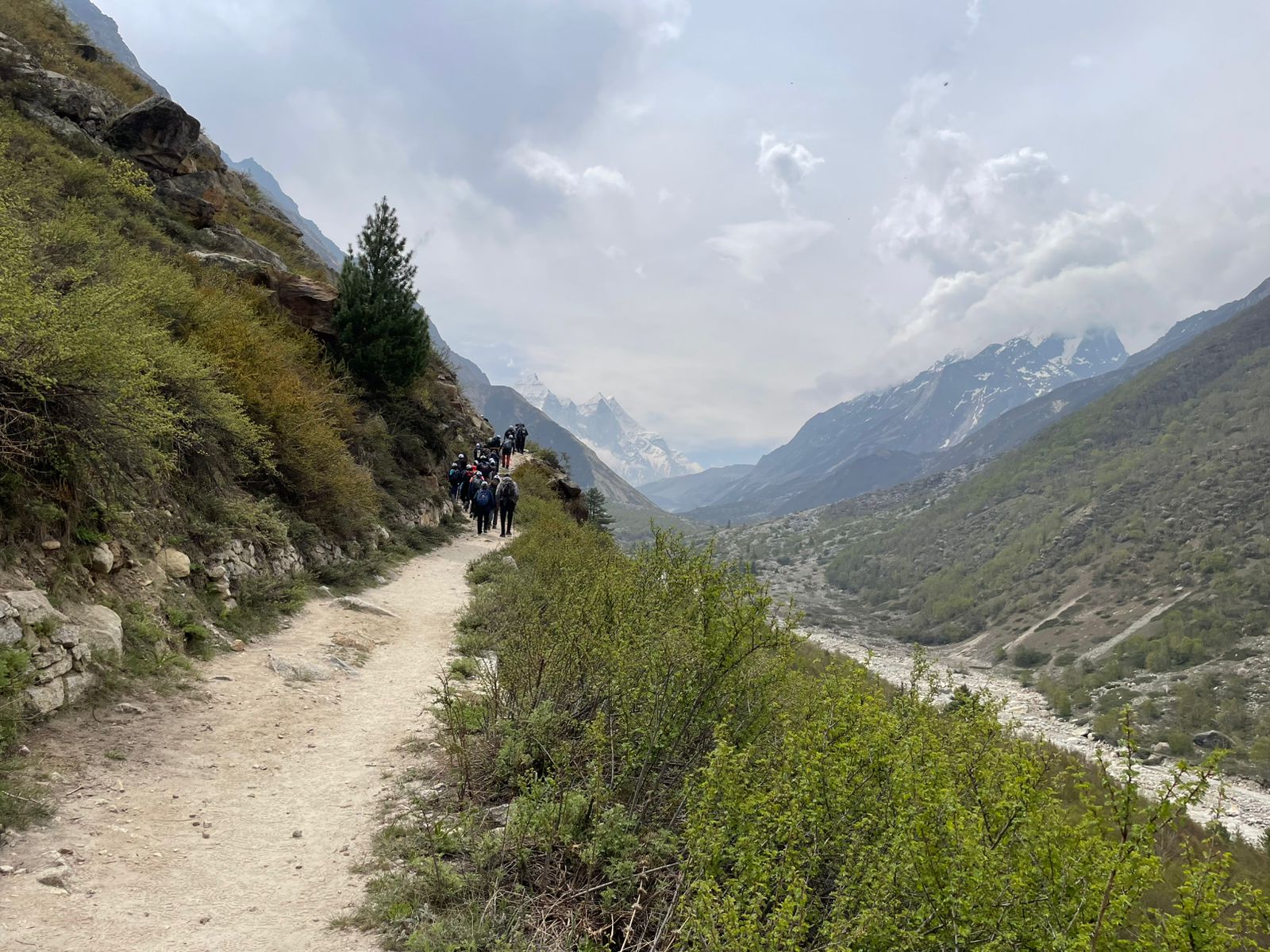
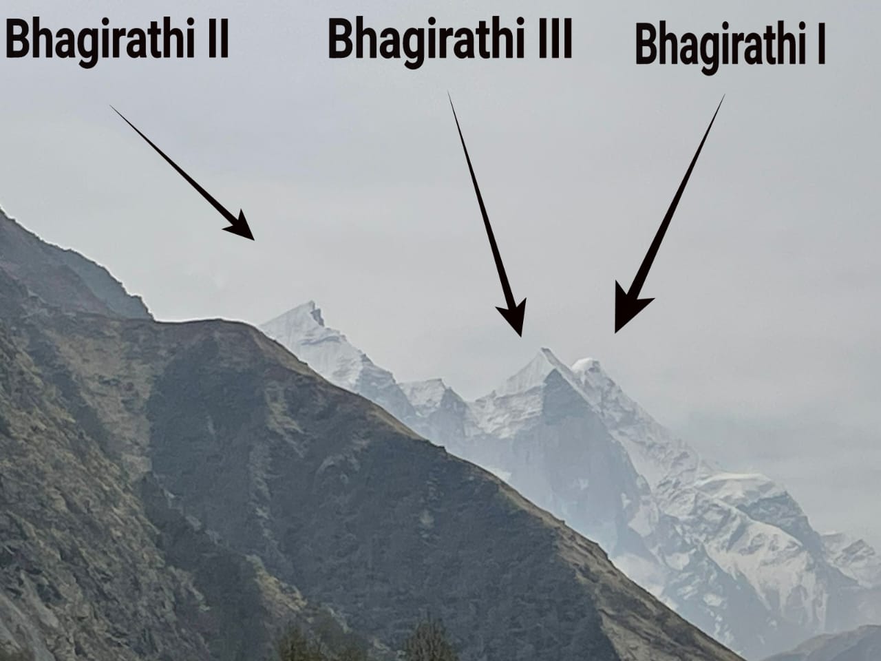
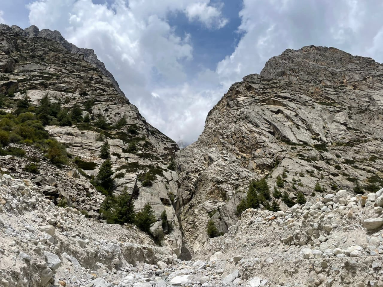
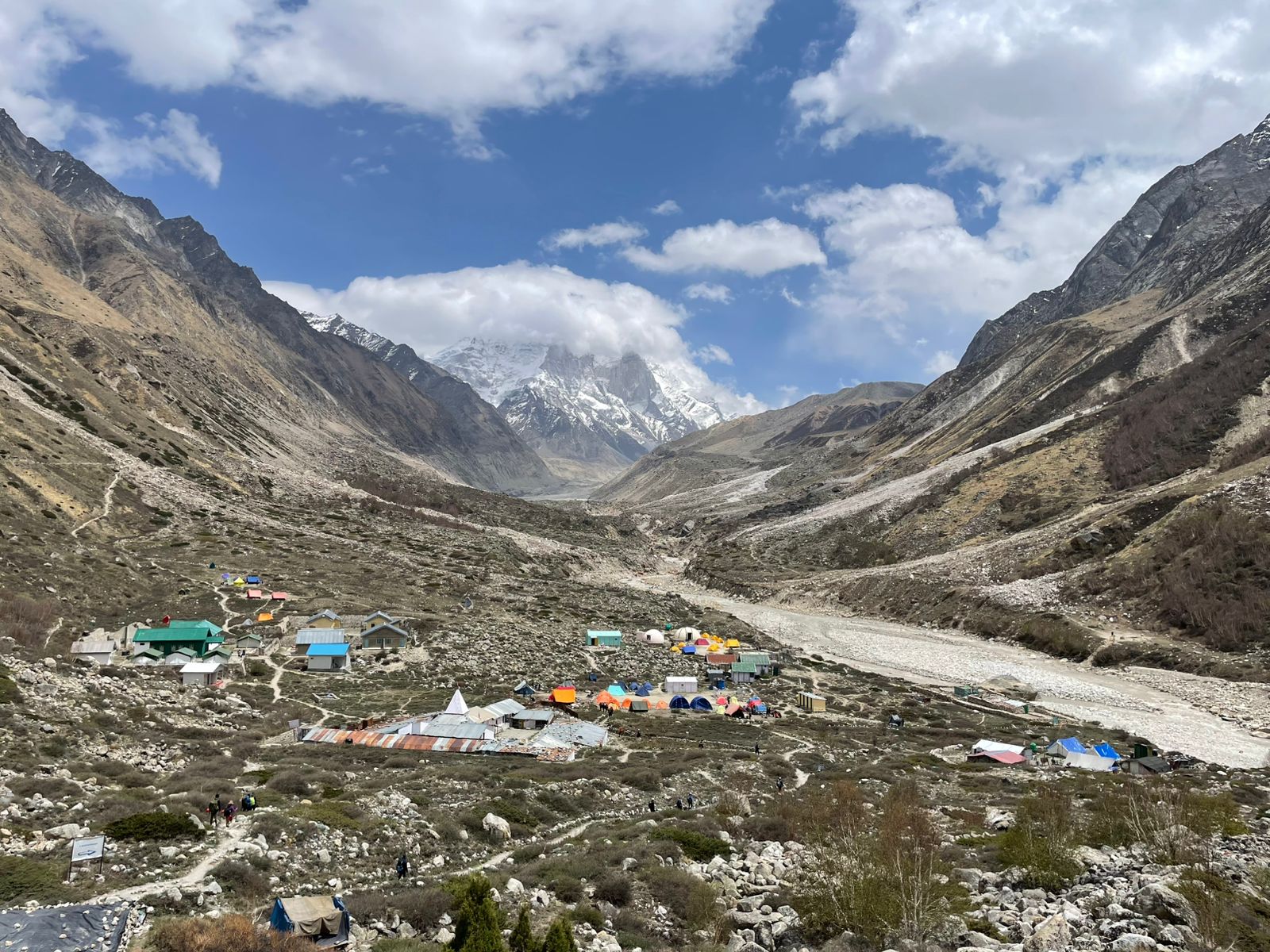
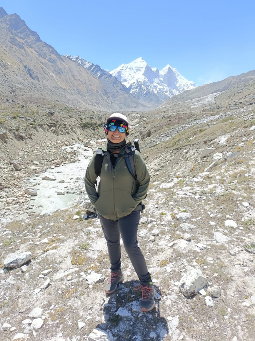
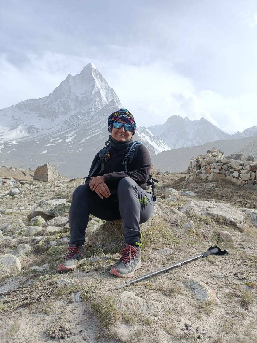
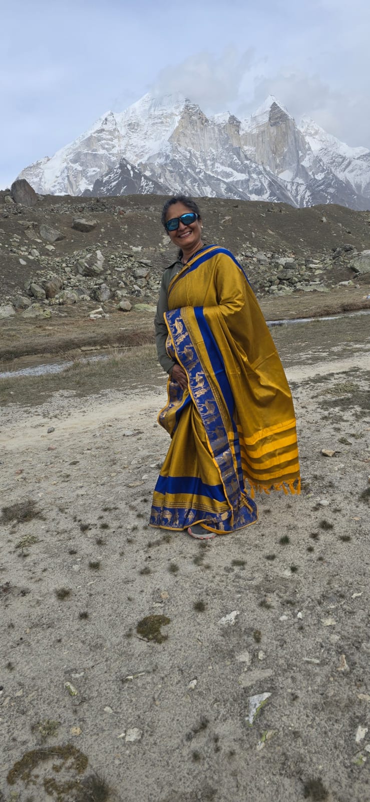
*Tapovan, Gaumukh, Mount Shivling, Mount Meru, and Mount Bhagirathi *— forms one of the most sacred and geographically important high-altitude landscapes in the Indian Himalayas. It is not only geologically significant, but also deeply rooted in Indian mythology and spirituality, especially in the context of the river Ganga (Ganges). ### *1. Geographical Overview:* #### *Tapovan:* * Tapovan is a high-altitude meadow (approx. 4,463 m or 14,640 ft) located above *Gaumukh* in the *Gangotri Glacier region* of Uttarakhand. * It serves as a base camp for treks to several Himalayan peaks and offers panoramic views of: * *Mount Shivling* * *Mount Bhagirathi (I, II, III)* * *Mount Meru* #### *Mount Shivling (6,543 m):* * A pyramidal, visually striking peak. * Often called the "Matterhorn of the Himalayas." * Located near Gaumukh and Tapovan. * Associated with *Lord Shiva*, and hence the name “Shivling.” * *Gangotri Glacier*, forming part of the Bhagirathi river basin. * Named after *King Bhagirath, the legendary figure who brought Ganga to Earth (6,660 m):* * A central peak in the region with high spiritual and mythologica Hindu, Buddhist, and Jain cosmology). Peak in the Gangotri region is known for its "Shark’s Fin" — one of the most difficult ascents in mountaineering. --- ### *2. Gaumukh and the Origin of Bhagirathi River:* #### *Gaumukh:* * Literally means “cow’s mouth” (गौमुख) due to the snout-like shape of the glacier’s terminus. * This is the *glacial terminus of the Gangotri Glacier, where the **Bhagirathi River* originates. * The water emerging from here is considered the physical origin of the **River Ganga Gang Ganga flowing from the heavens to Earth. * In the *puranic* description, it is said to fall from *Lord Shiva’s locks* to break its mighty descent and avoid Earth’s destruction. * *Mount Shivling* is often interpreted as the symbolic place where *Aakash Ganga* touches Earth — representing the fall of Ganga onto Shiva’s matted hair. -- 1. *Gangotri Glacier* is the source of the *Bhagirathi River, emerging at **Gaumukh* * beautifully in this region: * *Mount Shivling* is symbolically the *receiver* of the celestial Ganga. * *Gaumukh* is the *physical emergence* of the holy water from glacial ice. * *Tapovan* is the seat of penance (as per legends of sages and King Bhagirath). * *Bhagirathi River* is named after *King Bhagirath*, who is credited (mythologically) with bringing Ganga to Earth for the salvation of his ancestors. * The *merging of Bhagirathi and Alaknanda* at Devprayag is both a spiritual and hydrological *threshold* — a junction of divine and physical realms. Scenic Tapovan.background pic s. after hectic high altitude treck minus 3 temperature till all energetic dynamic friends Sharing few glimpses of treck GAUMUKH TAPOVAN Day 1 : Gangotri to Chidbasa After completing a full day tiring journey from Dehradun, we finally reached Gangotri late in the evening. Took blessings from Ganga Maiyya and started our trek from Gangotri to Chidbasa the next day. An amazing trail of 10km surrounded by mighty mountains…. Blessed to view peaks like Manda and Bhagirathi sisters. Height gain : 1800ft Altitude : 11800ft Day 2 : Chidbasa to Bhojbasa The night is spent in dome shaped tents n out of comfort zone to some extent… yet the day begins with cute smiles, sweet chirping of birds and the sound of River Ganga flowing by the side of the campsite. The trail that runs from Chidbasa to Bhojbasa is a short one… just 5km gradually inclining terrain. The crucial part here was crossing 5 rockfall zones safely but eyes had a real treat with continuous sight of Bhagirathi peaks along with many other unnamed yet mind boggling peaks. Height gain : 1000ft Altitude : 12800ft